
English| EUR
Suggested for you
More currencies
Choose a language
Nineteen and a half kilometres of volcanic plateau separate Mangatepopo from Ketetahi, and the clock behind that number is what most first-timers get wrong. This how long to hike tongariro alpine crossing guide sets out the honest range — from fast walkers to those stopping for photographs — and explains the conditions that stretch it. The track itself is open around the clock, with free entry, so the only real constraint is daylight and your own legs.
Quick answer
Most hikers complete the Tongariro Alpine Crossing in six to eight hours over roughly 19.4 kilometres, walking one-way from Mangatepopo to Ketetahi. Fit, unburdened walkers finish nearer five; groups pausing at the Emerald Lakes or Red Crater often need nine. Winter conditions, when ice axes and crampons become necessary, can add several hours. Starting between 07:00 and 09:00 keeps the finish comfortably before sunset.
The Tongariro Alpine Crossing is not a loop. That single structural fact governs everything about its duration: hikers walk one direction across the saddle between Mount Tongariro and Mount Ngauruhoe, and the shuttle waiting at Ketetahi does not care how the day went. There is no shortcut home from the halfway point. Anyone asking how long to hike tongariro alpine crossing is really asking how long they can sustain a steady pace over exposed volcanic ground, because the track offers no bail-out once the Devil's Staircase is behind them. The published figure — six to eight hours — averages out enormous variation. The first stretch along the Mangatepopo Valley is deceptively gentle, and hikers who push hard there frequently pay for it on the climb to South Crater. Above 1,600 metres the surface changes character: loose scoria on the descent from Red Crater slows almost everyone, and the Emerald Lakes draw long, unplanned stops. Rain and the notorious crosswind on the ridge can halve walking speed. Volcanic activity at Te Maari and Mount Ruapehu has closed sections in the past, and the Department of Conservation's alerts remain the authority on current status. The practical response is to plan for the slower end of the range rather than the faster. Track duration should be treated as a budget, not a target: an eight-hour allowance leaves room for the sulphur-scented detour toward Blue Lake, for a proper lunch above the Central Plateau, and for the knee-punishing final descent through beech forest to Ketetahi. Those weighing a Tongariro Alpine Crossing guided hike often find the timing question answers itself, since guides set the pace and carry the winter equipment. For independent walkers, the honest test of how long to hike tongariro alpine crossing is a recent day on comparable terrain — an eight-hour walk with 800 metres of gain elsewhere is the closest predictor available. Judge the number against that, not against the fastest time posted online, and the rest of the day's logistics fall into place.
“Track duration should be treated as a budget, not a target.”
This stage-by-stage plan suits a reasonably fit walker completing the full 19.4 km one-way route, and reflects the typical 6–8 hours most people take from Mangatepopo to Ketetahi. Times are cumulative walking hours, with short pauses built in.
Follow the boardwalk and valley floor toward Soda Springs on gentle gradient. Allow around 1 to 1.5 hours; the side spur to Soda Springs adds roughly 15 minutes return.
Ascend the steep switchbacks from the valley floor to the South Crater rim, gaining about 300 metres. Budget 45 to 60 minutes and expect slow single-file movement behind other walkers here.
Cross the flat volcanic basin between Mount Ngauruhoe and the Red Crater ridge, marked by poles. Roughly 30 minutes on level ground, though wind funnels hard across this open stretch.
Climb the loose ridge to the track's highest point at 1,886 metres, the steepest and most exposed section. Around 45 minutes up, with a scree descent immediately after that many find slower than expected.
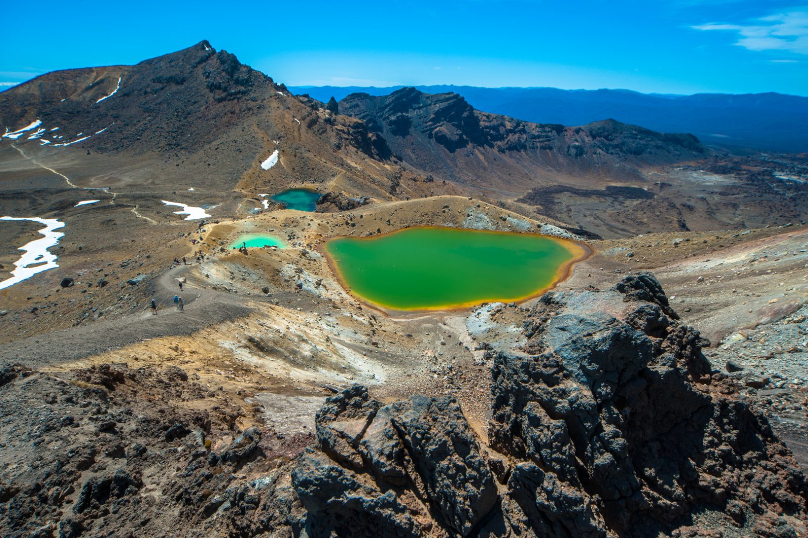
Descend past the Emerald Lakes, cross Central Crater, then pass Blue Lake. Allow 45 to 60 minutes including photo stops, and note the sulphur smell near the lakes is normal.
Switchback down the northern slopes past the Ketetahi Shelter, with views over Lake Rotoaira. This upper section takes about 1 to 1.5 hours; toilets are available at the shelter.
Finish through beech forest and the Mangatepopo Stream footbridge to Ketetahi car park. The last 1 to 1.5 hours feels longer than it looks, so pace the descent to protect tired knees.
The best arrival window is 07:00–09:00 to avoid midday crowds and ensure completion before sunset. Selecting the correct season is essential for safe navigation through changing alpine conditions.
Warm, 10°C to 20°C; clear stable days
Variable, 5°C to 15°C; potential high winds
Cold, 0°C to 8°C; snow and ice risk
—; Ideal for consistent pace and daylight usage.
Verdict: The best time to hike is during the shoulder months of March or November, arriving between 07:00–09:00 on a weekday to manage crowd levels and daylight hours.
Completing the 19.4 km crossing within daylight depends on preparation you make weeks ahead, not just what you carry on the day.
The Tongariro Alpine Crossing is located in Tongariro National Park, New Zealand. As a point-to-point track, it is best accessed via professional shuttle services that connect the start at Mangatepopo Road and the end at Ketetahi Road.
State Highway 46 and 47 to access car parks
Shuttle services from National Park Village or Turangi
Track access from Mangatepopo Road
The best arrival window is 07:00–09:00 to avoid midday crowds and ensure completion before sunset. Utilizing a shuttle service is recommended to manage the logistical requirement of the track's point-to-point nature.
The Tongariro Alpine Crossing is located in Tongariro National Park and remains accessible to visitors throughout the week. While the trail is officially open at all hours, hikers are advised to complete the trek during daylight.
Everything you need to know about how long to hike tongariro alpine crossing
Most hikers spend 6 to 8 hours to complete the 19.4-kilometre journey. The exact duration for how long to hike tongariro alpine crossing depends on your personal fitness level, the number of breaks you take, and trail conditions. Planning for a full 8-hour day ensures a comfortable pace throughout the volcanic terrain. You should keep in mind that how long to hike tongariro alpine crossing varies significantly if you are an inexperienced walker or encounter poor weather. Taking enough time to enjoy the views is a key part of the experience. It is not recommended for children under 10 years of age due to the challenging terrain and the overall duration required to complete the hike. Families should consider shorter, easier alternatives within Tongariro National Park that better suit younger children. Assessing the physical ability of your group is essential before deciding how long to hike tongariro alpine crossing with a family. We recommend arriving between 07:00–09:00 to avoid the largest midday crowds. Starting within this window also provides a safety buffer to ensure you finish your trek well before sunset. Early arrival is the best strategy for hikers wondering how long to hike tongariro alpine crossing while managing daylight hours. There is no entrance fee for the track itself. You will not pay any gate or ticket costs to access the volcanic landscapes of Tongariro National Park, though private transport services will charge for their shuttle loops. The trail is open 00:00–23:59 daily, making it accessible at all hours. If conditions deteriorate, you are advised to turn back if you have not yet reached the Red Crater. If you have already passed this point, it is usually safer to continue at a steady pace to the finish rather than stopping. Always monitor weather forecasts before departure to ensure a safe day on the mountain. Because the trek is a point-to-point route rather than a loop, a shuttle is effectively required to return to your vehicle or accommodation. While there is no fee to walk the trail itself, you must budget for the cost of these private shuttle services. Most visitors book their transport in advance to ensure a seamless experience at both the start and the end of the track.