
English| EUR
Suggested for you
More currencies
Choose a language
The 19.4-kilometre traverse between Mangatepopo and Ketetahi is New Zealand's best-known day walk, and most people do it without a guide. Independence here is legal and normal, but it is not unregulated. This page sets out what an unguided crossing requires before boots touch volcanic gravel.
Quick answer
Yes — walking it independently is permitted, and entry to Tongariro National Park costs 0 NZD, though a mandatory booking is required for hikers. The park itself is open 00:00–23:59 every day, but the recommended arrival window is 06:00–09:00. Winter conditions between roughly June and October demand alpine equipment and experience, and unguided travel is discouraged then.
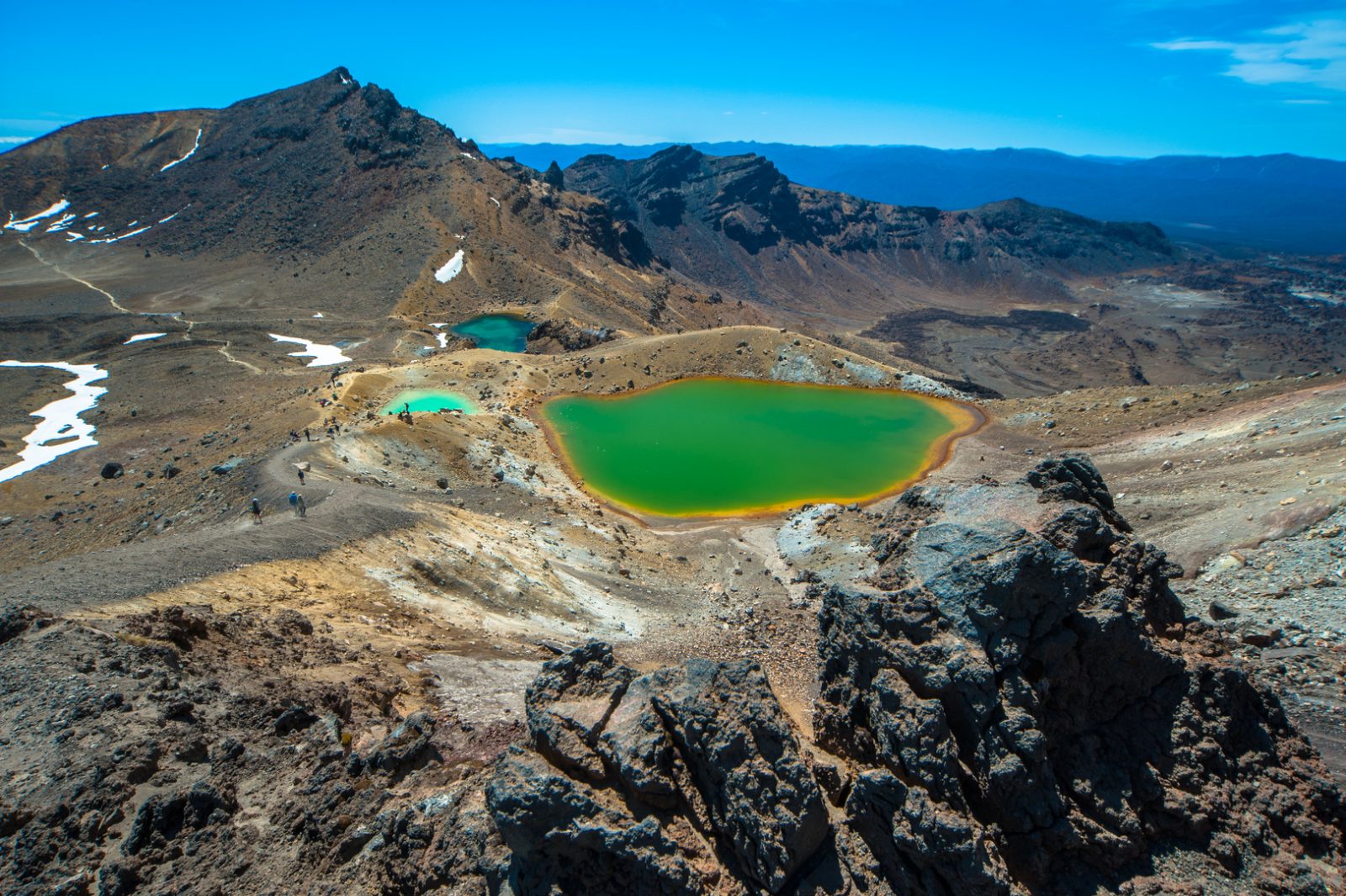
The trail crosses the flank of an active volcano. Mount Ngauruhoe last erupted in 1975, and Te Maari crater on Mount Tongariro erupted without warning in August 2012, throwing rock across a section of track that walkers use today. That geology is why the Department of Conservation treats a self guided tongariro crossing as a serious alpine undertaking rather than a long bushwalk, and why the route carries a booking requirement that many first-time visitors discover only after arriving in Whakapapa or National Park Village. What an independent walker is dealing with is a one-way traverse of roughly 19.4 kilometres with about 765 metres of ascent, starting at the Mangatepopo road end and finishing at Ketetahi. The two ends do not connect by any short loop, which is the single fact that shapes every other decision. The Devil's Staircase climbs out of the Mangatepopo valley onto the South Crater, a flat pan of ash that offers no shelter when cloud closes in. Above it, the Red Crater ridge sits at 1,886 metres and forms the highest and most exposed point, with a loose scoria descent to the Emerald Lakes below. Ngā Tapuwae o te Ariki, the footsteps of the chief, is the Ngāti Tūwharetoa name for these lakes; the whole massif is sacred to the iwi, and the summit of Ngauruhoe is closed to climbers out of respect. The dual World Heritage listing recognises both that cultural weight and the volcanic landscape itself. Context explains the rules. A guided walk supplies weather judgement, spare layers and a decision-maker; a Tongariro National Park day hike undertaken alone supplies none of that, so the responsibility transfers entirely to the walker. Weather on the crossing changes faster than most visitors expect, and the alpine section holds snow and ice well outside winter. There is no drinking water on the route, no shelter beyond a basic toilet block, and mobile coverage is patchy at best. What to do with all of this is practical. Treat the self guided tongariro crossing as a fixed-window commitment rather than a flexible day out: check the forecast the night before, confirm the booking, and be honest about turning back at Red Crater if conditions deteriorate. The unguided Tongariro traverse rewards preparation and punishes improvisation, and the detailed timing, transport and equipment sections of this site cover each of those decisions in turn.
“The two ends of the track do not connect by any short loop — that single fact shapes every other decision an independent walker makes.”
The best time to visit is during the shoulder seasons of summer, specifically from February to April or November to early December. Visitors should strictly adhere to the best arrival window of 06:00–09:00 to avoid mid-day heat, weather changes, and to ensure completion before evening darkness.
Warm, 10°C to 20°C. High UV levels.
Expect clear paths but busy trails; requires early arrival for parking.
Cooler, 5°C to 15°C. Unpredictable winds.
Offers a balance of stable conditions and manageable foot traffic.
Cold, below 0°C to 10°C. Snow hazards.
Alpine conditions require winter skills and equipment; not suitable for standard hiking.
—
Arriving at 06:00 provides the most stable weather and quietest trail experience.
Verdict: The optimal time is a weekday during the shoulder months of March or November, arriving within the 06:00–09:00 window.
This procedure takes you from securing the mandatory hiker booking through to finishing at Ketetahi car park, covering the 19.4 km alpine route unguided. Most walkers spend six to eight hours on the track itself, with booking and preparation handled in the days beforehand.
Entry to Tongariro National Park costs 0 NZD, but every crossing hiker must hold a booking made in advance through the Department of Conservation at https://www.doc.govt.nz. The common mistake is assuming free entry means no booking is needed — walkers without a confirmed reservation can be turned back at the trailhead.
Check that the name, date and any shuttle reference on your confirmation match the day you intend to walk, and save an offline copy to your phone. There is no mobile coverage across most of the route, so a booking you can only open online is a booking you cannot show.
Read the DOC alpine forecast and track status for the crossing on the morning you walk, or phone +64 7 892 3729 if anything is unclear. People routinely commit to the walk on a fine forecast in Whakapapa or Turangi and meet very different conditions on the Red Crater saddle.
Arrive between 06:00 and 09:00, sign the intentions register and begin walking the valley floor toward Soda Springs. The gentle first hour misleads people into setting a fast pace they cannot hold on the climb that follows.
Ascend the steep zigzag from Soda Springs to South Crater, gaining roughly 350 metres in under two kilometres. Turning back here is entirely reasonable and far easier than doing so from the ridge above.
Traverse the flat crater floor, then take the exposed ridge to the high point at Red Crater. This narrow section is where wind and low cloud cause most problems, so assess it before committing rather than mid-ridge.
Drop down the loose scree slope with short, controlled steps, then continue past the Emerald Lakes and across Central Crater. The scree tempts people into running it, which is how most ankle injuries on the route happen.
Follow the graded track down past the Ketetahi shelter and through beech forest to the Ketetahi car park, allowing around two hours. Tired legs and a long, monotonous descent make this the stretch where footing lapses, so keep pace steady to the end.
The Tongariro Alpine Crossing is located in Tongariro National Park, Manawatu-Wanganui, New Zealand. Because the trail is a one-way point-to-point hike, most visitors utilize shuttle services to connect the trailheads.
State Highway 46 to Mangatepopo Road
Shuttle from National Park Village or Turangi
From Mangatepopo Car Park
Parking at the trailheads is strictly regulated with time limits, making shuttle services the recommended transport method. Aim for the best arrival window of 06:00–09:00 to ensure completion before darkness.
Work through these preparation steps in order, starting weeks out and finishing the morning you set off on the 19.4 km alpine route.
Tongariro National Park remains open to visitors throughout the week, providing access to the Tongariro Alpine Crossing at all times.
Everything you need to know about self guided tongariro crossing
Yes, you can complete the hike independently. A self guided tongariro crossing is a popular way to experience the volcanic terrain of the park at your own pace.
There is no entrance fee for the track itself. As of 2026, the Tongariro Alpine Crossing remains free for all visitors.
The best arrival window is between 06:00 and 09:00. Starting early helps you avoid mid-day heat and ensures you complete the hike before evening darkness falls.
Most hikers take between 6 and 8 hours to complete the 19.4km distance. The exact time depends on your fitness level and the number of stops you take for photography.
Yes, while there is no cost, a mandatory booking is required for all hikers. This ensures the Department of Conservation can manage visitor numbers and send safety updates.
If conditions become poor, the track can be dangerous due to volcanic scree and weather changes. It is advised to monitor local forecasts and use alternative tracks like the Taranaki Falls walk if necessary.
The track is physically challenging with steep climbs and rocky descents, making it unsuitable for small children. A high level of fitness is recommended for all participants on the trail.